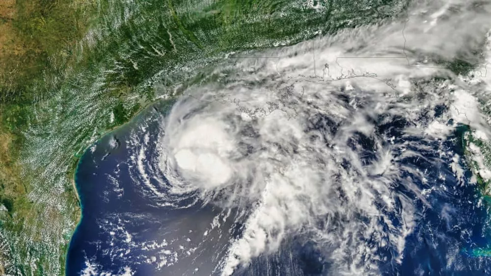
Hurricane Francine gained strength as it headed towards the Louisiana coast currently a category 1 hurricane, with forecasters warning residents of life-threatening conditions. Francine is expected to bring heavy rain and winds, which could turn into urban and coastal flooding once the storm reaches land.
Francine was upgraded to a hurricane late Tuesday as it moved across warm Gulf waters off the Texas and Louisiana coastlines, with landfall expected in Louisiana on Wednesday. As of 5 a.m. ET the storm was about 245 miles south-west of Morgan City, Louisiana, with sustained wind speeds of 90 mph, moving north-east at a rate of 10 mph. Forecasters said Francine’s landfall was expected Wednesday afternoon or evening as a Category 2 hurricane with winds of 96 to 110 mph (155 to 175 kph) and strong storm surge.
A hurricane warning is in place across most of the Louisiana coastline (from Sabine Pass eastward to Grand Isle, La.), while a storm surge warning covers the area from High Island, near Houston, all the way to the Mississippi and Alabama border.
Louisiana Gov. Jeff Landry has declared a state of emergency, urging residents to “batten down all the hatches” and stay in place rather than venturing out onto the roads and risk blocking first responders or utility crews working to repair power lines. Mississippi Gov. Tate Reeves also declared a state of emergency, he announced Tuesday afternoon.
According to the National Hurricane Center. Mississippi’s coastal counties were under a tropical storm warning, with a hurricane warning in effect along the Louisiana coast from the border with Texas eastward to Grand Isle, about 50 miles (80 kilometers) south of New Orleans, and a tropical storm warning extended eastward from there to the Alabama/Florida state line.
Forecasters said that the storm system is expected to bring storm total rainfall of 4 to 8 inches, with local amounts to 12 inches across much of Louisiana and Mississippi through early Friday. From Port Fourchon to the mouth of the Mississippi River could see storm surge as high as 7 feet while High Island, Texas, near the Bolivar Peninsula, could see it reach 5 feet.
Editorial credit: BEST-BACKGROUNDS / Shutterstock.com


